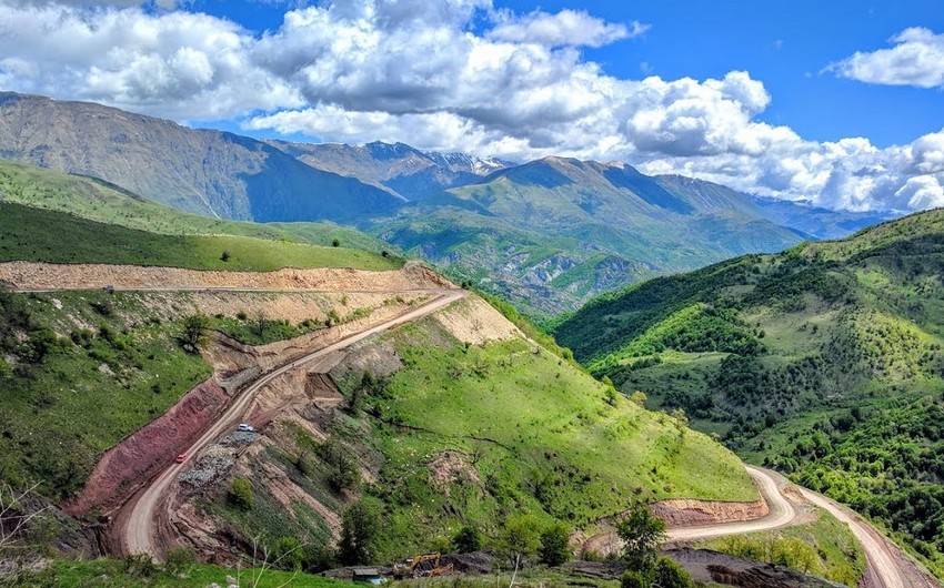
Geographical situation
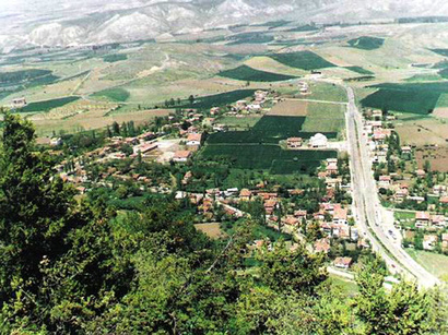
The region of Gubadly is the administrative region of the Republic of Azerbaijan. It is located in the south-western part of the Minor Caucasus. In the west, it neighbors with the Republic of Armenia. Its area is 800 km2; The central town is the city of Gubadly.
The region has been under the Armenian occupation since August 31, 1993.
The region covers the following districts and villages: city of Gubadly and villages of Aliguluushaghy; Mahmudlu; Saryyatag; Khanlyg; Gayaly; Lepeheyranly; Abdalanly; Dondarly; Dileli Muskanly; Saray; Mirler; Demirchiler; Poladly; Ferjan; Goyyal; Hertis; Zor; Ashaghy Khojamusakhly; Mehrili; Hal; Gazyan; Memer; Mollaly; Ballygaya; Jereli; Boyunegher; Saldash; Garalar; Kavdadyg; Huseynushaghy; Ulashly; Altynja; Abilja; Tatar; Garagoyunlu; Ghiyasly; Zilanly; Kurd Mahryzly; Seleli; Mahryzly; Alagurshagly; Muganly; Hamzali; Chaytumas; Efendiler; Yusifbayli; Khojahan; Tinli; Ghilijan; Yukhary Mollu; Ashaghy Mollu, Mollaburhan; Khochik; Mardanly; Balasoltanly; Padar; Garamanly; Garachally; Garagach; Garakishiler; Basharat; Milanly; Hat; Deshdahat; Armudlu; Chardagly; Tarovlu; Khalach; Ayin; Goyerchik; Bakhtiyarly; Goyar Abbas; Chylfyr; Seytas; Novlu; Gurchulu; Dovudlu; Ghedirli; Mazra; Eyvazly; Teymur Muskanly; Balahasanli; Khydyrly; Ashaghy Jibikli; Yukhary Jibikli; Kheliloba; Muradkhanly; Hekeri; Ishygly; Khendek; Malikahmadli and Gundanly.
Economic characteristic
The basis of the economy of the region is agriculture comprisng grain growing, vine-growing, cultivation of tobacco, cattle-breeding, silkworm breeding. Industrial enterprises comprise dairy, vine processing plants, sewing factory. The region has been occuped by armenian military troops since 1993.
Socio-economic conclusions of the occupation
Stats for August 1993:
Territory – 802 sq. km
Families – 8,331
Population – 30,678 persons (36,700 in 2011).
Killed – 80 persons
Handicapped – 722 persons
Orphaned – 435 persons
Destruction and losses
Villages and settlements – 95
Dwelling houses – 6,999
Industrial and construction establishments – 15
Service establishments – 291
Schools – 78
Health care centres – 13
Cultural establishments – 285
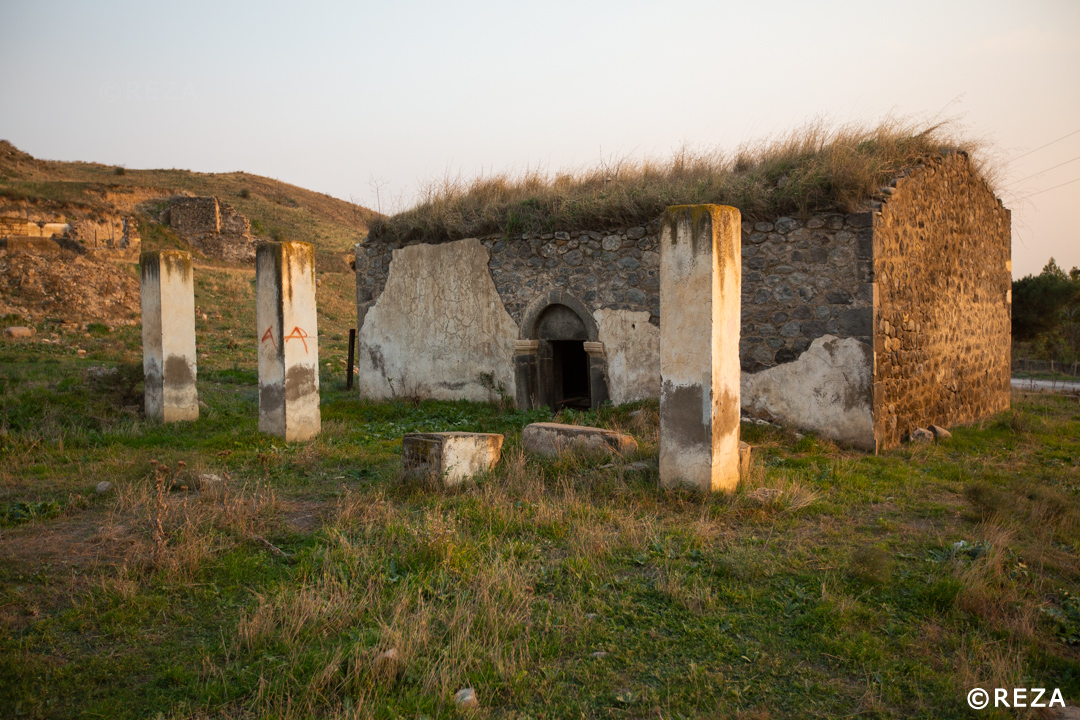
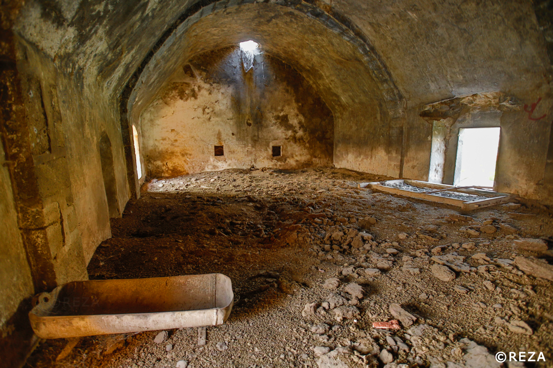
Cultural monuments
The region had such architectural monuments as the Prayer Cave (4th century), the tower of the in Muradkhanili village (5th century), the Geygala tower near Aliushagi village, two mausoleums of Damirchilar village (14th-17th centuries), the mosque (19th century) and the bridges Lalazar (1867) and Hadji Badal which connect the banks of the mountainous rivers.
Tombs in Damirchilar Village
There are two tower-shaped tombs in the territory of Damirchilar village of Gubadly region. One of them is located on the right bank of the mountain river Aghachay. The shape of the tomb is octagonal (one side is 1.9m). Inside of the tomb there is a small sanctuary niche built in the wall opposite the door. The interior walls were faced with good-hewn stone plates. The inner height of the tomb is 4.5 m.
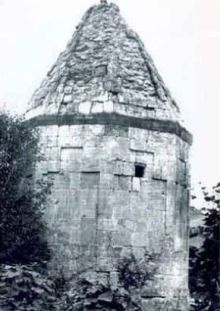
All exterior sides of the tomb were built in the shape of shouldered shallow arches typical for Arazboyu tombs of the Elkhanids’ period. Small windows were set in the middle of the eastern and western niches.
The door is at a height of 1.2 m above ground level. Being 5m high, the prismatic drum of the tomb was covered with an octahedral pyramidal dome. The space between that dome and the inner spherical dome was filled with big empty pitchers.
The second tomb is located near the right-bank slope of the river Aghachay, between Damirchilar and Dondarli villages. Due to its advantageous position, the tomb is well seen even from a remote distance. It has an octagonal shape as well (one side is 2.03 m on the outside and 1.40 m on the inside). By building material, construction engineering and architectural decision, this monument is identical to the first tomb. Except that dimensions of the first tomb are a little bigger (the inner size of the upper camera is 6.2 m, the height of the body is 6.90 m) and the shape of shouldered shallow niches in the inner walls is different from that of the first tomb. Both of these tombs are considered to be the monuments dated back to the 13th-14th centuries.
At present there is no any information about those shrines currently remaining under occupation.
Lalazar Bridge
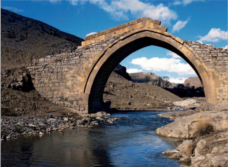
The bridge is located in Aliguluushaghi village of Gubadly region. The amazing masterpiece of architecture – Lalazar Bridge was built in 1867. The lower part of the bridge is oval, the upper part is plain. Both piers of Lalazar Bridge stick to the high rocks. Some researchers suggest that the bridge was built in the 18th century. The bridge of 2.8 meters in width and 5 meters in length is located 4.5 meters high above the water surface.
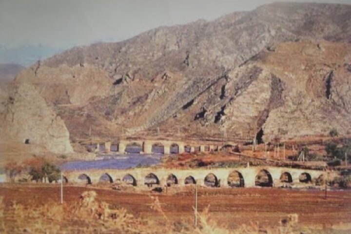
Haji Badal Bridge

The bridge was built on Agha River by the resident of Damirchilar village – a person having an innate talent Haji Badal. Special ornamental stone, lime and egg yolks were used in construction of the bridge. The bridge linked 15 villages to the region centre.
The bridge is an interesting piece of architecture. The vaulted bridge has no piers in the central part. The purpose of such a construction was to facilitate the unobstructed water flow of the overflowing mountain river.
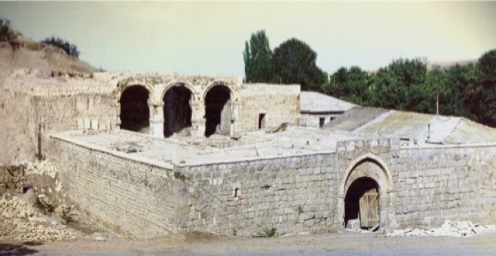
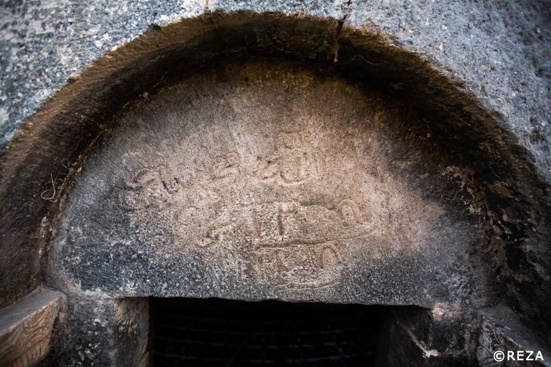
Mosque in Mamar Village
The mosque was built in the 18th century in Mamar village of Gubadly Region. It was used as a warehouse building during the reign of the Soviet Power. After the restoring of independence that mosque was reconstructed and regained its original function. The mosque was destroyed after the occupation of the Gubadly Region by the Armenian Armed Forces.