Geographical situation
Kalbajar is the highest mountain region of Azerbaijan with the highest point being Garnish (3,724 m). The main part of the region is covered by forests. There are 200 mineral springs on the territory of the region. It has 132 populated points in the region. The region was occupied by Armenian military troops since 1993.
The region covers the following districts and villages: city of Kelbajar; district of Istisu and villages of Zivel; Keshdek; Nadirkhanly; Takhtabashy; Hasanriz; Gozlu; Gozlu Korpu; Narynjlar; Cherektar; Lev; Abdullaushaghi; Garachanly; Agyatag; Fetalilar; Mozkend; Agdaban; Chaygovushan; Agjakend; Orujlu; Zagalar; Tezekend; Yenikend; Ali Bayramly; Vezirkhana; Almalyg; Lachyn; Asrik; Choban Kerekmez; Chorman; Ashaghy Ayrim; Yukhary Ayrim; Boyagly; Baglypeye; Veng; Baghyrly; Bashlybel; Khallanly; Alirzalar; Shahkerem; Chovdar; Dalghylyjly; Otagly; Dereghyshlag; Barmagbine; Otgyshlag; Damirchidam; Ganlykend; Zar; Veng; Yellija; Alolar; Kaha; Hasanlar; Armudlu; Tekdam; Zeylik; Hopurlu; Sheyinli; Zulfugarly; Garaguney; Kechiligaya; Istibulag; Goydere; Agdash; Gamyshly; Baghirsag; Jomard; Garaguney; Najafalylar; Piriler; Kilseli; Alchaly; Gushyuvasy; Gylychly; Guzeychirkin; Alchaly; Merchimek; Aggaya; Chopurlu; Birinji Milli; Ikinji Milli; Uchunchu Milli; Guneshli; Allykend; Boyur; Alchaly; Orta Garachanly; Bash Garachanly; Ashaghy Garachanly; Tatlar; Imambinesi; Kholazey; Alkhasy; Sarydash; Guneypeye; Seyidler; Jamilli; Susuzlug; Gasymbinesi; Synyg Kilse; Bashkend; Tirkeshevend; Zargula; Gazkhanly; Galaboyun; Garakhanchally; Chaykend; Kendyeri; Kilse; Ashaghy Khach; Mishni; Chapli; Elyaslylar; Shaplar; Mammadushaghy; Ashagy Shurtan; Yukhary Shurtan; Soyugbulag; Tekegaya; Babashlar; Bozlu; Chyrag; Tovledere; Mammadsefi; Yanshag; Zallar; Yanshagbine; Dovshanly; Bazarkend; Hayad; Ghyzylgaya; Yukhary Oratag; Vangli; Chormanly; Shahmansurlu; Heyvaly; Devedashy; Yayiji; Imaret Gervend; Chapar; Zerdekhach; Kolatag; Damgaly; Chyldyran and Mehmana.
Ecomonic characteristics
The basis of the economy of the region is agriculture which is specialised in cattle-breeding and grain growing.
At the height more than 3 thousand meters on Aychmgilli and Penchingil mountains, you can see the unique petrographers which receipted name of Kalbajar rock paintings. They were related to the Bronze Ages. Riches of theme, original topics and art value of these pictures which are cut on the basalt rocks attract the attention of explorers here not far from here was discovered one of the ancient stands of man.
This land is famous for its mineral waters, natural resources and woods.
Socio-economic conclusions of the occupation
August 1993:
Territory – 3,054 sq. km
Families – 14,780
Population – 60,698 (83,200 in 2011)
Killed – 458
Handicapped – 510
Orphaned – 734
Destruction and losses
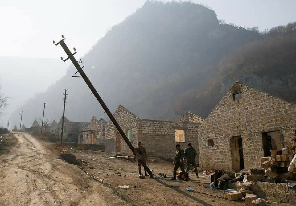
Villages and settlements – 150
Dwelling houses – 11,130
Industrial and construction establishments – 8
Service establishments – 383
Schools – 97
Health care centres – 120
Cultural establishments – 318
Farms – 54
Museum – 1
Sanatorium – 1
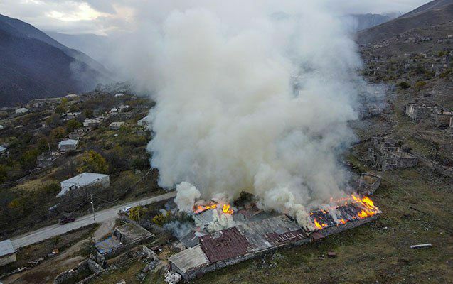
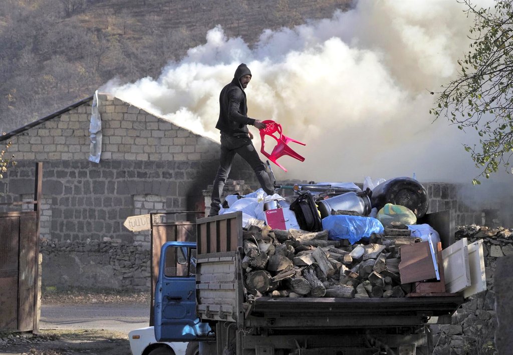
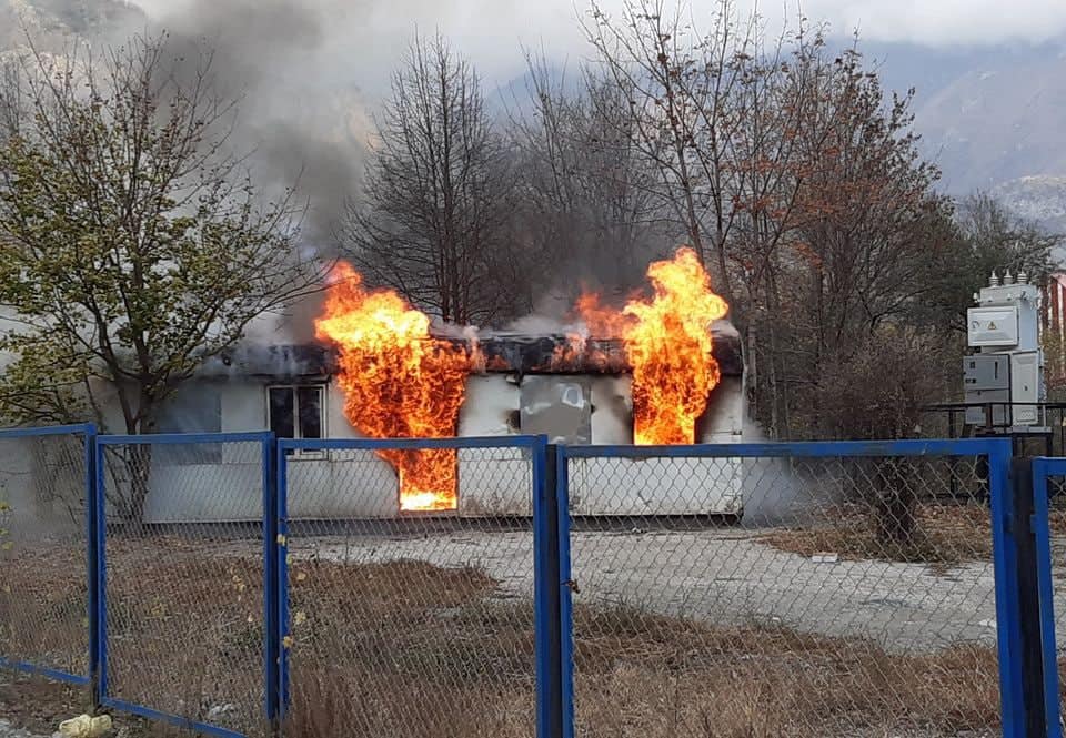
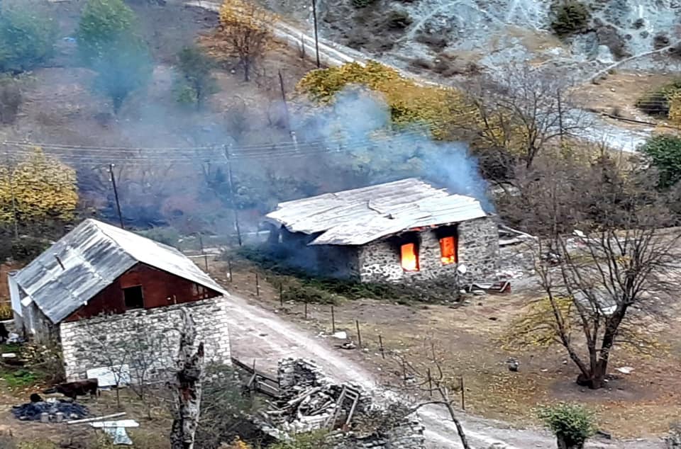
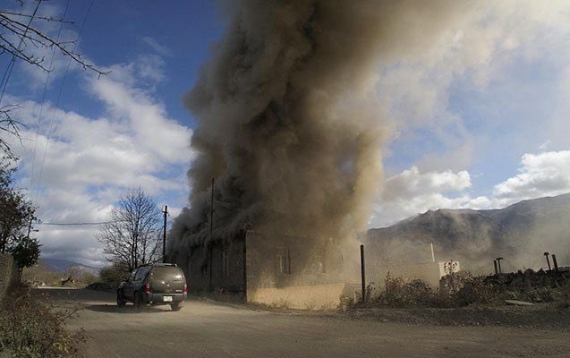
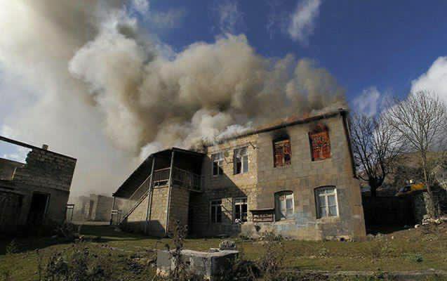
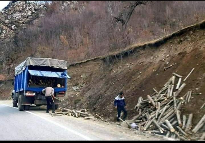
After the peace agreement in November 2020, illegal Armenian settlers burned most of the remaining inhabitable houses, destroyed infrastructure and cut down trees as they were leaving.
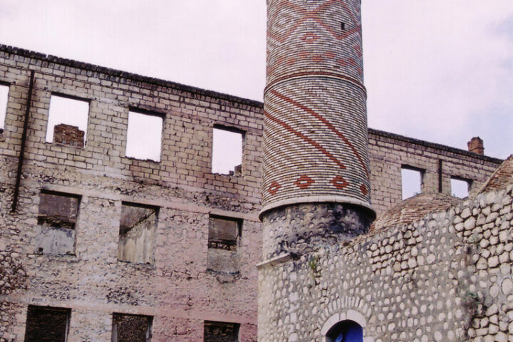
Cultural monuments
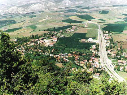
Istisu
Kalbajar district is famous in the world for its Istisu mineral springs, and “Istisu” health resort. At Istisu there are therapeutic mineral and hot springs where people used to go for treatment of rheumatism and arthritis. “Istisu” health resort is located in the western part of Kalbajar – on the slope of the mountain range. Istisu mineral springs appeared as a result of an earth tremor and cracking during the earthquake in 1138.
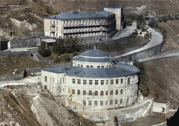
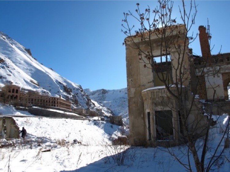
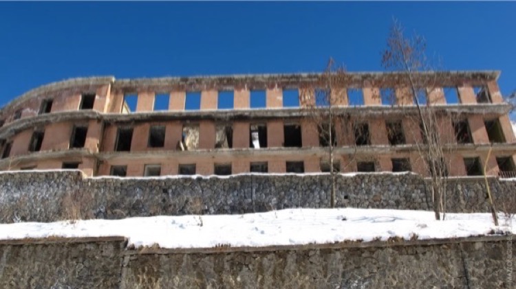
Setting up the health resort in Istisu has been in the spotlight of the Azerbaijani Government since 1925, after the establishment of the Soviet power.
Chemical analysis of Istisu mineral water was first made in 1929, while a resort construction commenced in the late 1920s. Medical resorts, hospitals and hotels were built in Upper Istisu in 1951.
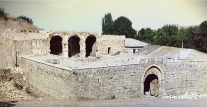
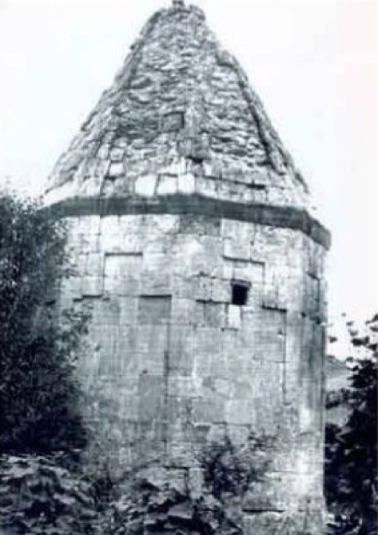
Khudavang Monastery Complex
Khudavang, or Dedeveng, located in the Vang village of Kalbajar region, on the Terterchay river’s left bank, is one of the largest and most beautiful examples of Azerbaijan’s Christian architecture.
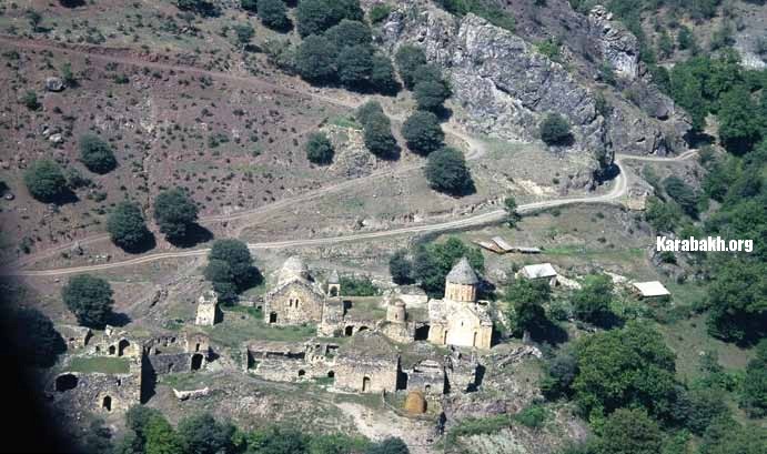
The Khudavank monastery complex, Kalbajar, 13th century. 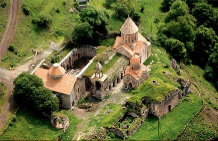
By the legend, Apostle Thaddeus, the first Christian missionary in the Caucasus, was buried there. Therefore, the complex is supposed to have been founded in the 4th century.
The complex was mainly constructed in the 13th century, in the reign of Albanian king Vakhtang. The monastery complex currently includes more than twenty buildings and ruins. The main church was built in 1214 by Arzu Khatun, king Vakhtang’s wife. Dominating throughout the complex, its dome high and space majestic, the church is of the Caucasian-Albanian Christian masterpieces of architecture. It is believed that, Arzu Khatun and her daughters painted the interior murals.
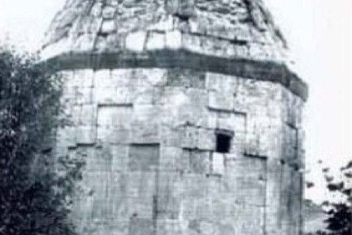
Lev Castle
Lev castle is one of the most majestic among the Kalbajar region’s highland ones. It was founded on a high forest mountain’s ridge 600 meters from the Lev River’s right bank, in Ganlikend village.
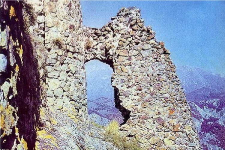
Surrounded by a steep rock and streams form three slides, the castle has an oblong and complicated plan matching the highland relief. The castle can only be entered through the single entrance at the castle’s north-eastern edge if one climbs up by an exclusive narrow path from the north-west.
The castle’s internal length is nearly 90 meters, and the width is between 35 and 40 meters. Its internal castle is located at the high south-western corner. The castle walls were strengthened with several semi-circular towers. The single gate is between two round towers. The average thickness of the castle walls is 1.3 meters.
There are ruins, in-rock water basins and food warehouses, etc. There were sentinel derricks and a system of small satellite castles in mountains around Lev castle. One of those mountains has kept the function-meeting name of the castle which is on its top, Garavul (Guard).
From there, another castle, Jomard, is observed. Lev castle was constructed in the 13th-14th centuries.