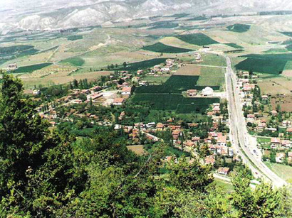
Geographical situation
The region of Jabrayil is the administrative region of the Republic of Azerbaijan. The region is situated on the south-east of the Greater Caucasus. In the south and the south-eastern part, it neighbours with the Islamic Republic of Iran. The central town is the city of Jabrayil.
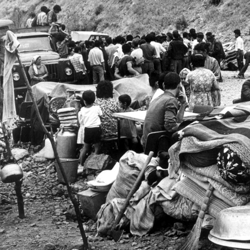
The region’s territory has been under the Armenian occupation since August 23, 1993.
The region covers the following districts and villages – city of Jabrayil; districts of Gumlag, Khalafli; Khudaferin, Mahmudlu and villages of Yarahmadli; Khudaverdili; Gurbantepe; Shahveledli; Khubyarly; Imambaghi; Horovlu; Chapand; Safarsha; Chereken; Papy; Efendiler; Balyand; Garajally; Doshulu; Suleymanly; Dashkesen; Ghyshlag; Guychag; Sheybey; Nuzgar; Shahvelli; Niyazgullar; Tinli; Govshudlu; Haji Isagly; Goshabulag; Shukurbayli; Shykhalyagaly; Fuganly; Dejel; Amirvarly; Sarychally; Mazra; Yukhary Mazra; Soltanly; Kechal Mammadli; Yanarkhach; Alykeykhaly; Mashanly; Hasanly; Mehdili; Chakhyrly; Minbashyly; Sadi; Agtepe; Kavdar; Mirek; Huseynalylar; Hajyly; Tulus; Dag Tumas; Garagach; Sofulu; Chelebiler; Dag Mashanly; Gazanzemi; Soyudlu; Ashaghy Maralyan; Yukhary Maralyan; Karkhulu; Jafarabad; Isagly; Galachyg; Hovuslu; Sirik; Ashaghy Sirik; Shykhlar; Mollahasanli; Asgarkhanly; Khalafli; Garer; Kudlar; Nusus; Tatar; Gumlag; Mastalybayli; Goyarchin; Veysalli; Boyuk Marjanly; Yukhary Marjanly, Khanagabulag; Chullu; Derzili; Dash Veysalli; Yukhary Nusus; Ashyq Melikli; Niftalylar; Gushchular; Hasangaydy; Mahmudlu; Chochug Marjanly.
Economic characteristics
Before the occupation the basis of the economy of the region was agriculture specialised in cattle breeding and vine growing. There were 5 vine processing plants and 8 industrial objects.
Socio-economic conclusions of the occupation
August 1993
| Territory | 1,050 sq. km |
| Families | 14,112 |
| Population | 57,125 (72,700 in 2011) |
| Killed | 353 persons |
| Handicapped | 368 persons |
| Orphaned | 218 persons |
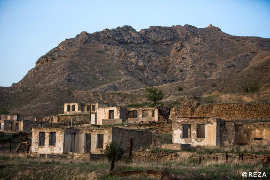
Destruction and losses
| Billages and settlements | 96 |
| Dwelling houses | 9,242 |
| Industrial and construction establishments | 17 |
| Service establishments | 383 |
| Schools | 114 |
| Health care centres | 17 |
| Cultural establishments | 138 |
| Farms | 44 |
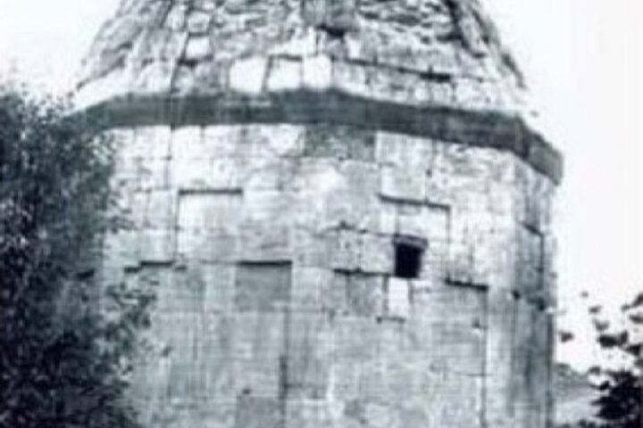
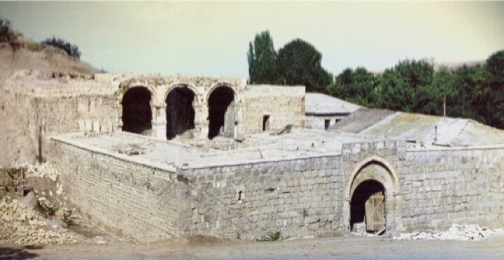
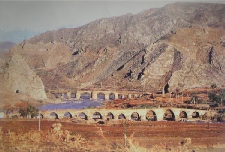
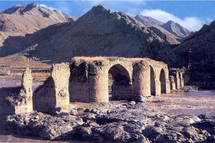
Cultural monuments
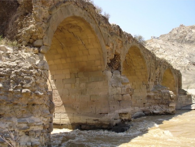
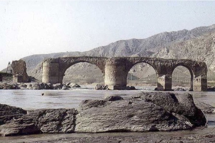
One of two Khudaferin bridges 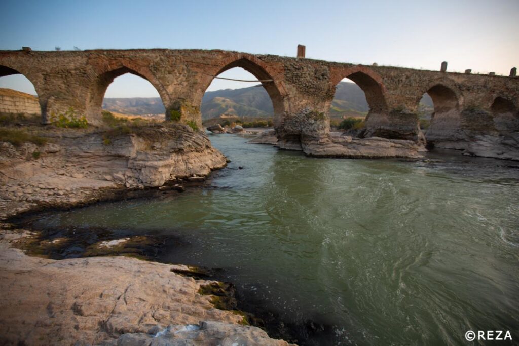
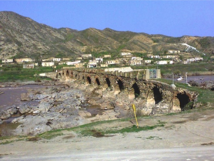
One of two Khudaferin bridges right after Jabrayil liberation
The famous Khudaferin bridges across the Araz river that are located between Kumlah and Khudaferin (Khodaafarin) settlements could be served as symbol of Jabrayil. These distinguished bridges are the ancient architectural monuments and evidences of Azerbaijan’s historical past.
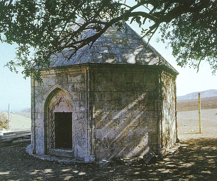
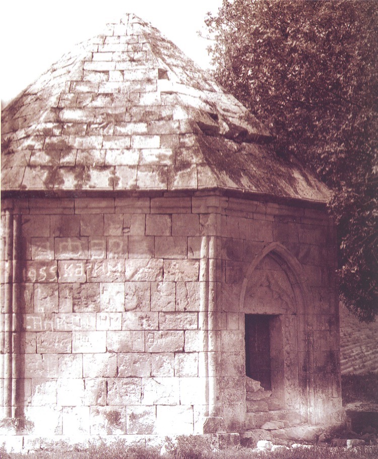
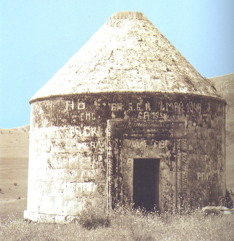
There are also a lot of other archeological and architectural monuments on the territory of the district. A remarkable piece of the medieval architecture – “Dairevi” (Round) tomb built in the 15th century, located in Khubyarly village in the north of Jabrayil city and octagonal tomb built in the 16th century were fully restored by the special maintenance crew before the occupation of the Jabrayil region. According to the information received, those monuments were also razed to the ground by the Armenian invaders.
The territory of the district was occupied by the armenian military troops in 1993. Even the famous bridges could not save the women, children and oldmen of Jabrayil during the military operations. They had to save their lives crossing the Araz river. And there were not many people who managed to rescue.
The people of Azerbaijan will always keep the memory about the terrible tragedies and the cruel slaughter of innocent residents of the region.
Sources: