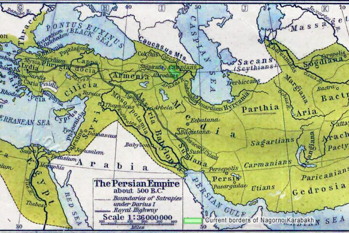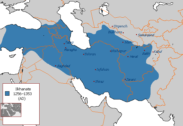
Karabakh has been an integral part of Azerbaijan for the whole period of history, including the XIII-XIV centuries. As was correctly noted by the prominent Russian Orientalist A. Y. Yakubovsky, by the name Azerbaijan in that period was meant the present day territory of South (Iranian) as well as North (former Soviet) Azerbaijan. (1) Its borders stretched from Zanjan to Derbent and from Lake Goycha (today Sevan) to the Caspian Sea. As a part of the Azerbaijani Safavid State the country was divided into four Beylarbeyliys: Chuhur-Saad, Ganja (Karabakh), Tabriz and Shirvan. In this period Karabakh formed part of the historical region Arran and was its centre and soul (2), which primary source information attests to.
The toponym Karabakh is encountered not only on Azerbaijani territory, but also in the region of Kars (Asia Minor), northern Caucasus, Turkmenistan, Uzbekistan, Afghanistan and other countries. (3) In Azerbaijan there were also localities called Surkhab Karabakh, Tabriz Karabakh (4) and Karabakh Arran. Marking these localities as Karabakh means people and garden, the great garden and excellent place and describes the beauty of the land and its abundance. The historian al-Kutbi al-Akhari (14th century) called Karabakh, the capital of Arran’. (5) As is known, post-medieval Arran covered the area between the Kura and Araz Rivers. The name Karabakh of Arran was used to highlight the difference between this and the other Karabakhs, especially Karabakh of Badgis situated to the east of the Caspian.
One ought to note that the toponym Nagorny (Mountainous) Karabakh is not encountered in the writing of medieval historians, in particular those of the XIII-XIV centuries. The mountainous and plains parts of Karabakh were historically interrelated in economic and cultural terms and closely complemented one another.
As is clear from these sources, the territory of Karabakh includes the land which began at the River Araz and extended in the north westerly direction from the east of Baylagan and the border of Gushtasfi to Zegamchay. According to a report by the XIV century author Hamdullah Gazvini the border of Karabakh stretched to the River Araz. (6)
The facts bear witness that Zegam, located north of Goykchi, (7) and all of Beylagan belong to Karabakh. They confirm the location of Karabakh on the border with Shirvan (8) and the extent of the Karabakh trade routes from the confluence of the Kura and Araz Rivers to Tbilisi. (9) All this suggests that the toponyms Karabakh and Arran were sometimes identified with each other. However, the XIV century author Fazlullah Rashid ad-Din called them ‘the regions of Karabakh, Mughan, Arran and Sheki’ (10) which refutes the aforesaid.
The work of Rashid ad-Din allows us to define the territory of Karabakh. He wrote that Gafan relates to the Nakhchivan tuman (region) and thus made clear that the Nakhchivan tuman(11) bordered Karabakh. And this gives evidence about the extent in the 13th-14th centuries of the borders of Karabakh, stretching in the south to the River Araz, in the southwest to the River Hakari, in the northwest to Zegamchay, in the north and northeast to the River Kura (the territory of Shirvan) and in the southeast to the Gushtasfi Region, and also about Karabakh being an administrative unit which united the Mountainous and Plains parts.